Mae Hong Son Loop with Dirt Bikes, 4 Days exploring remote areas of Northern Thailand
A 4-day, ~860km dirt bike loop from Chiang Mai through Om Koi, Mae Sariang, Khun Yuam and Pai — a ride report from the back roads of the Mae Hong Son loop, where the tarmac runs out and the Karen villages begin.
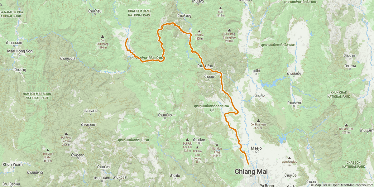
The Mae Hong Son loop is one of the most famous motorcycle rides in Southeast Asia — a 600-and-something kilometre ribbon of tarmac that climbs and switchbacks its way from Chiang Mai up to Pai, on to Mae Hong Son, down through Khun Yuam and Mae Sariang, and back via Hot. On a scooter or a touring bike, it's a glorious 3-day road trip. On a dirt bike, with four days and a willingness to ditch the asphalt, it becomes something else entirely.
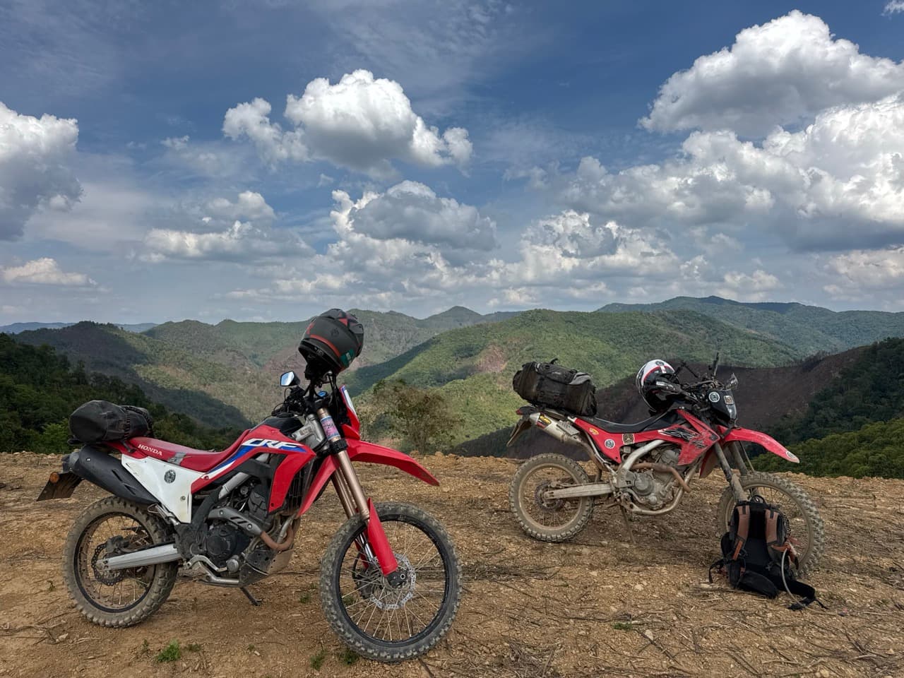
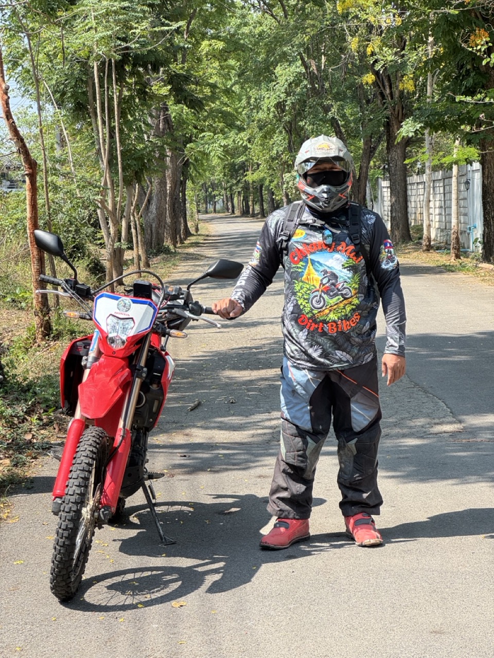
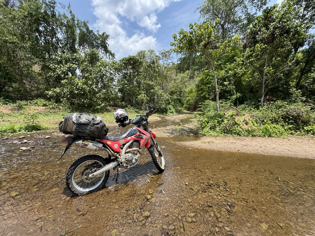
We did it on two CRFs at the start of May. The plan was simple on paper: ride the loop, but take the dirt option every chance we got, and add a southern detour through Om Koi — a remote Karen district south of Hot that almost nobody includes in the standard loop. What we got was four days of empty mountain roads, layered ridge views, riverbed crossings, hilltribe villages with goats on the road, and exactly two stretches of highway long enough to start feeling bored.
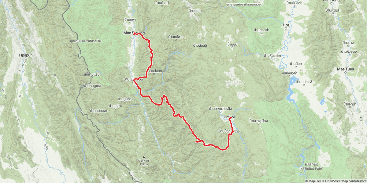
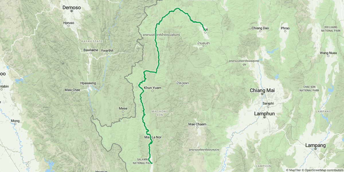
The Whole Loop, in One Map
Here's all four days plotted together. The colours match the per-day maps further down. We rode the loop counter-clockwise — south first, into Om Koi and Mae Sariang, then up the western edge to Khun Yuam and Pai, then back to Chiang Mai through Mae Taeng on the last day.
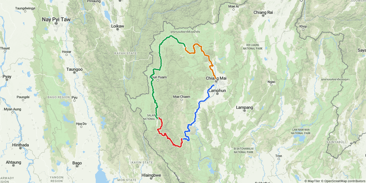
The Route at a Glance
| Day | Route | Distance | Sleep |
|---|---|---|---|
| Day 1 (Fri) | Chiang Mai → Hot → Om Koi | ~191 km | บ้านสวนธนารัตน์ ที่พักอมก๋อย, Om Koi |
| Day 2 (Sat) | Om Koi → Mae Sariang (the long mountain day) | ~171 km | Riverhouse Resort, Mae Sariang |
| Day 3 (Sun) | Mae Sariang → Mae La Noi → Khun Yuam → Pai | ~326 km | AI Pai, Pai |
| Day 4 (Mon) | Pai → Mae Taeng → Chiang Dao → Chiang Mai | ~171 km | Home |
Why Do This on a Dirt Bike?
The standard Mae Hong Son loop is paved end to end. Anyone with a Honda Click and a free week can ride it — and plenty of people do. So why bring a dirt bike?
Because the second you have one, the map changes. Every dotted line on the GPS that a road bike would skip becomes an option. The ride between Om Koi and Mae Sariang isn't really a road in the normal sense — it's a stitched-together network of dirt forestry tracks, ridge roads, and Karen village paths that links up if you're patient and reasonably comfortable on loose surfaces. Same on Day 3: there's a paved, comfortable way to get from Mae Sariang to Pai, and there's the way we took, which involved a couple of water crossings, a stretch of muddy jungle track, and a fishball noodle stop in Khun Yuam that felt like our own personal discovery.
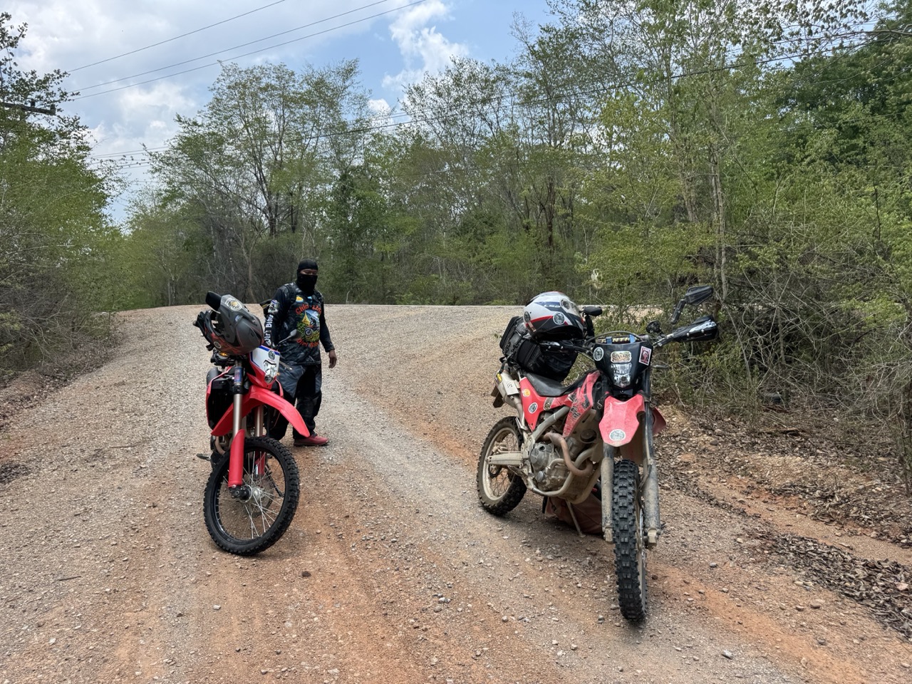
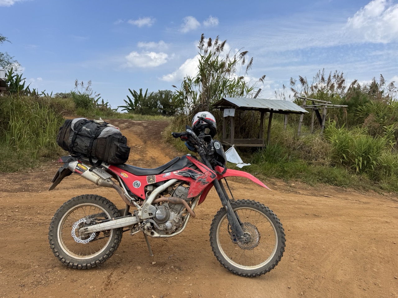
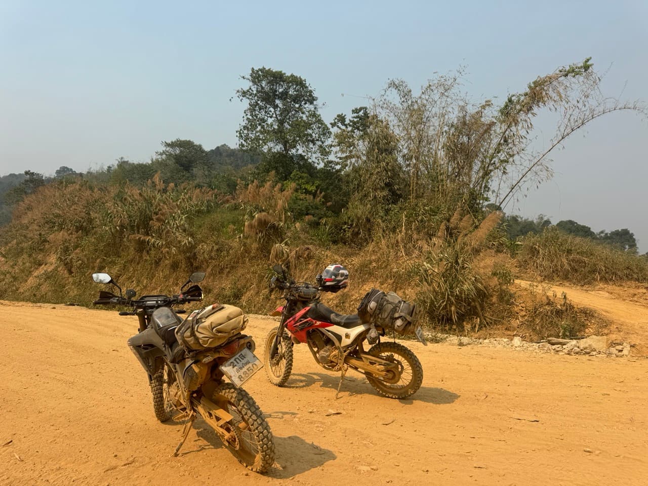
We were on Honda CRFs the whole way. A 250L or 300L is the sweet spot for this kind of trip — light enough to flick around the dirt sections, comfortable enough on the long tarmac transits, and a tank range that gets you between the small petrol stations of the deep west without sweating it.
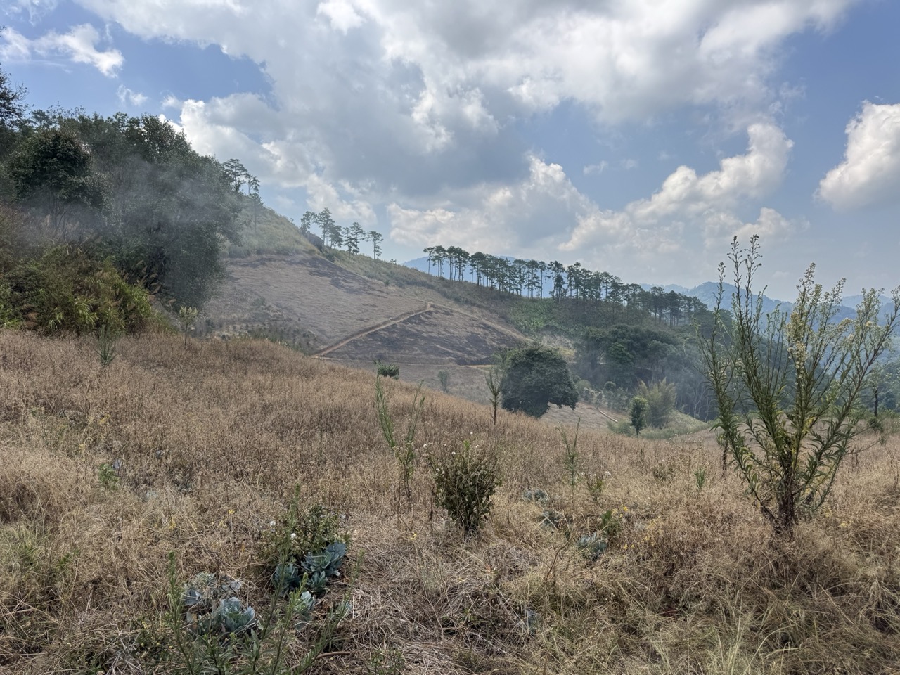
Heads up on the season: we rode in early May — the tail end of burning season. Some days the haze was bad enough that the layered mountain views had a yellow filter. The trade-off is that the trails were bone dry and fast, and we shared the loop with almost nobody. If you want clean air and crystal views, do this same loop in December or January instead.
Day 1 — Chiang Mai to Om Koi (~191 km)
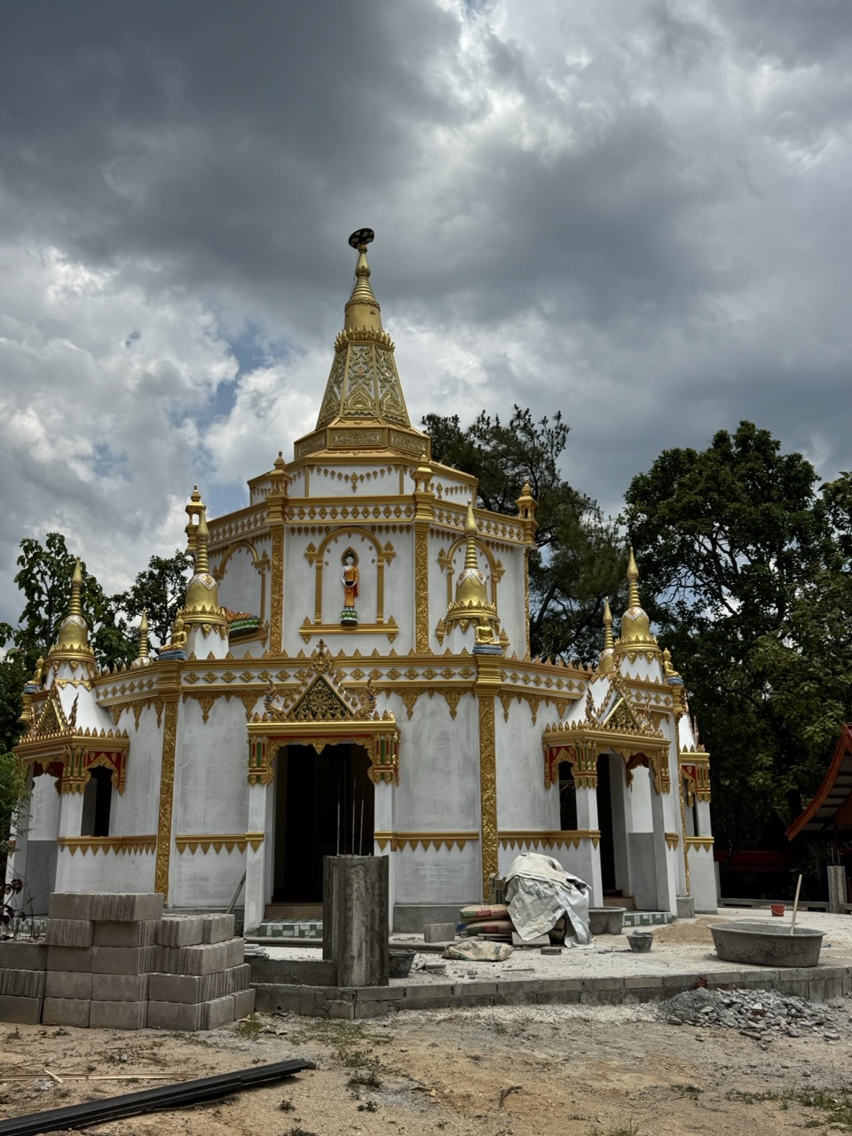
Day 1 is the warm-up day. We rolled out of Hang Dong south of Chiang Mai and pointed the bikes south on Route 108, which gets you down to Hot in a couple of hours of mostly easy riding. Hot itself is a small district town, but it's the gateway to everything interesting south of Doi Inthanon, and its centre has a startlingly white-and-gold temple under construction that's worth a stop.
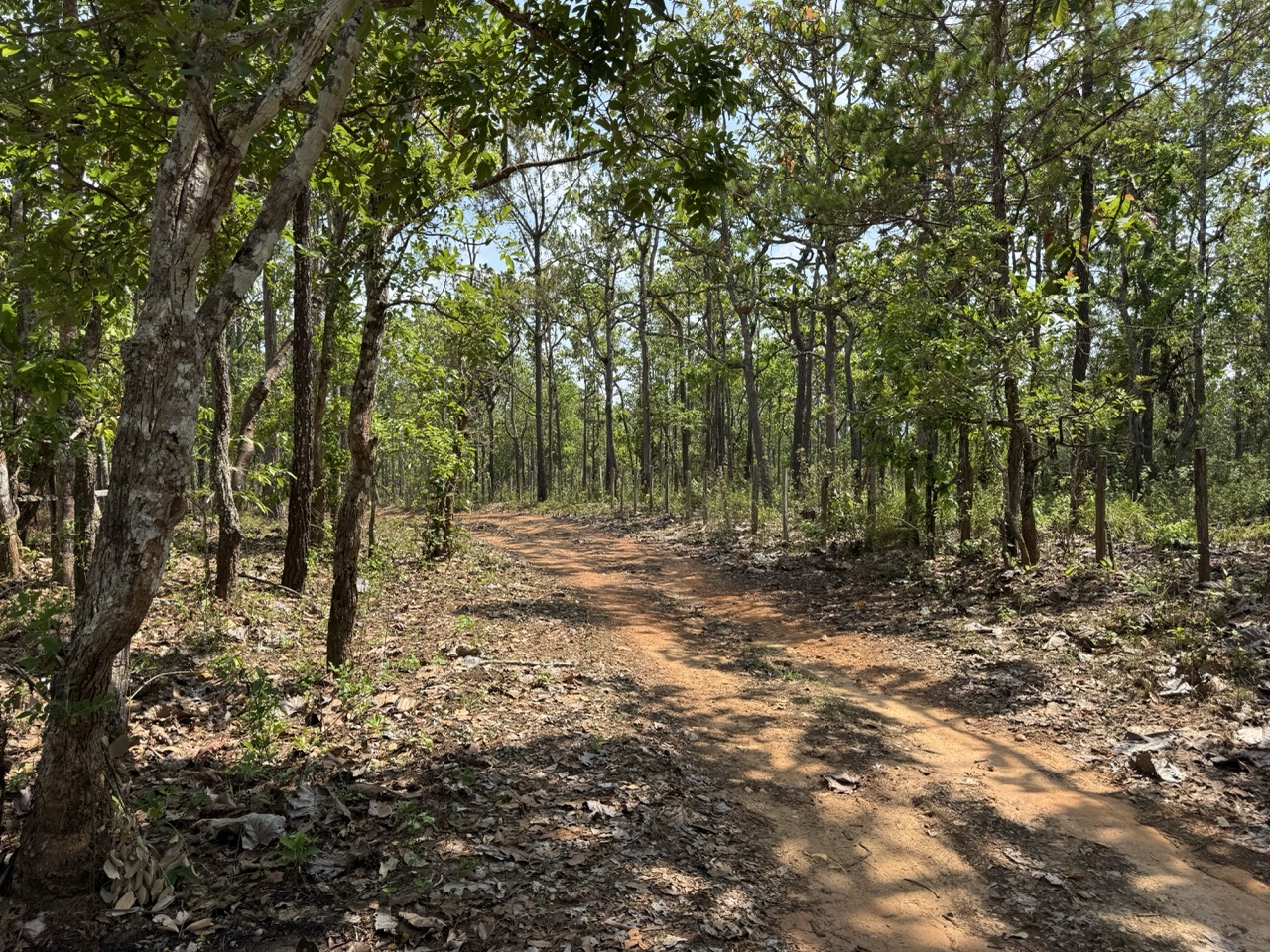
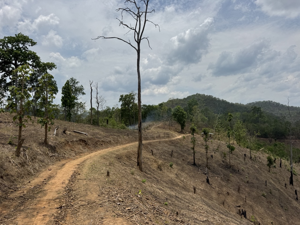
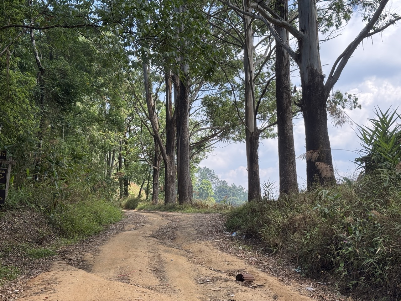
From Hot we left the highway for the first time and started picking dirt where we could. The terrain here is gentle — wide gravel forestry roads, the occasional packed-dirt double track, nothing that asks much of the bike or the rider. It's a good place to dial in tyre pressures and remember how to ride loose surfaces if you've been on tarmac for a while.
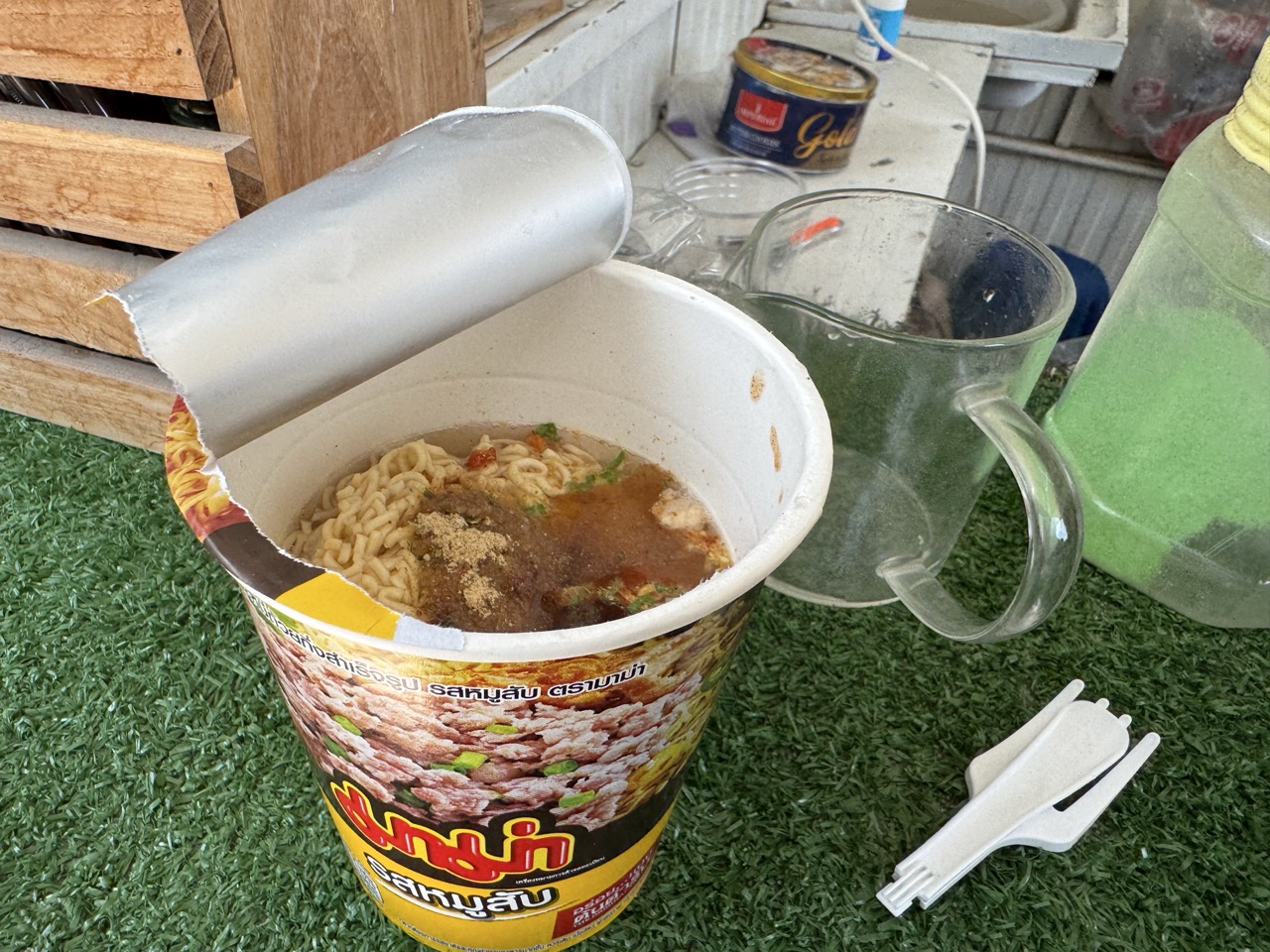
Lunch was a Mama instant-noodle stop at a roadside shack — the unofficial national meal of any rural Thai ride. Boil, slurp, pay 40 baht, keep going.
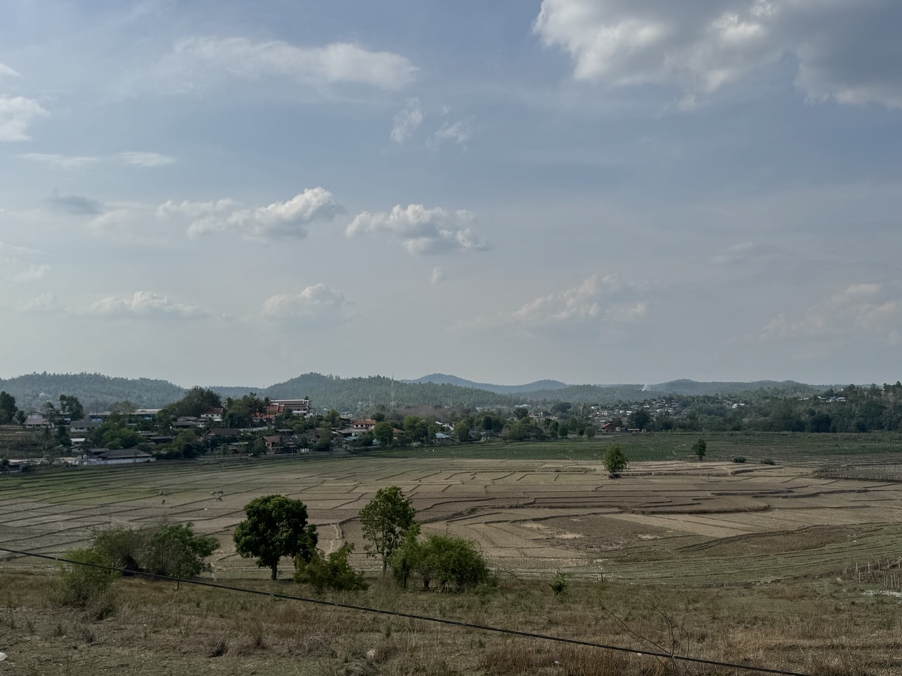
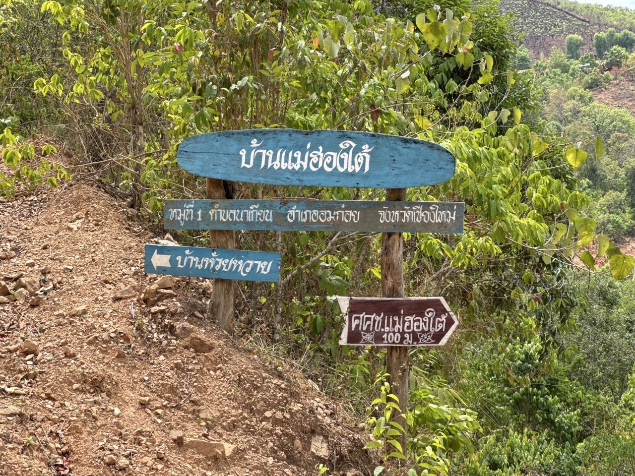
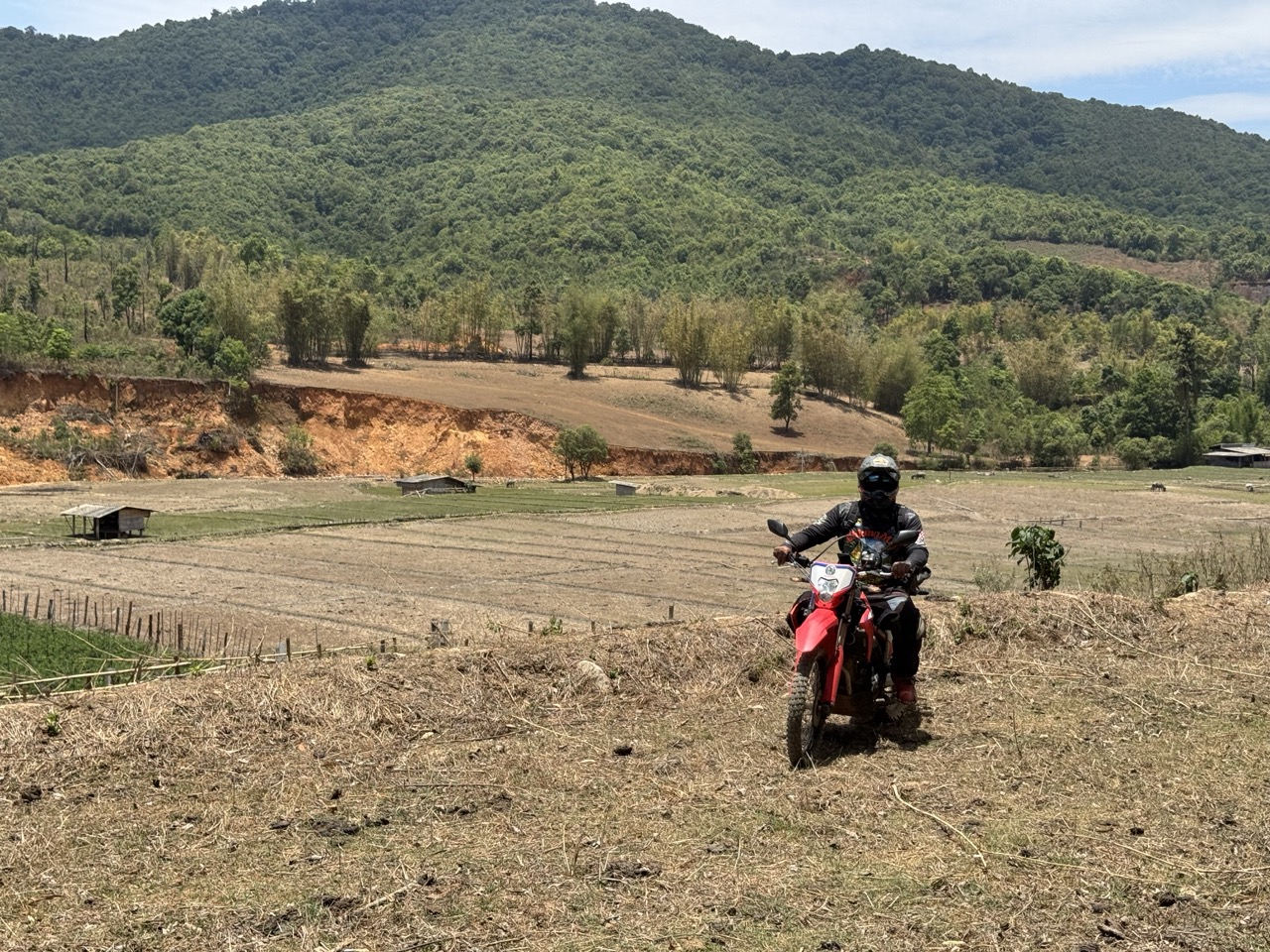
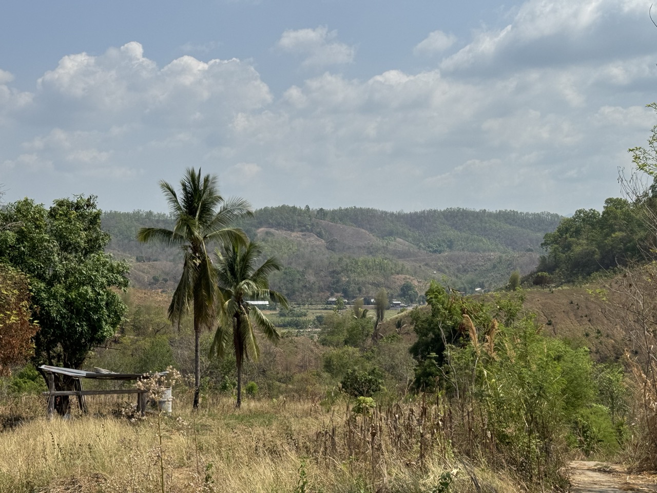
The push from Hot up to Om Koi is where the trip really starts. The road climbs into deciduous forest and the valleys open out into broad, dry rice-paddy bowls. Om Koi district is one of the largest Karen districts in Thailand — most of the villages you ride past are Karen (Pgaz K'Nyau / Sgaw and Pwo), and the rhythm of the place is completely different to anywhere within day-trip distance of Chiang Mai. Slower, quieter, more spread out.
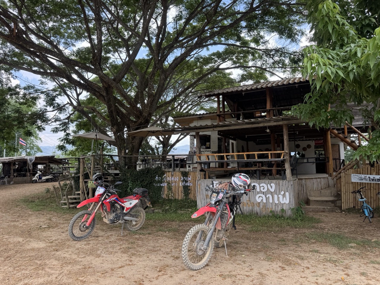
We pulled into Om Koi town in the late afternoon and checked into บ้านสวนธนารัตน์ ที่พักอมก๋อย, a friendly local guesthouse run as part of a family compound. Nothing fancy — clean rooms, fan, good shower, the dog is in charge of the courtyard — but it's exactly what you want after 190 km of riding.
Dinner was a charcoal-brazier hot pot at a small place around the corner. The brazier comes to the table loaded with glowing coals, the broth pot goes on top, and you spend the next hour grazing. Worth doing once even if you don't normally chase the food.
Day 2 — Om Koi to Mae Sariang (~171 km)
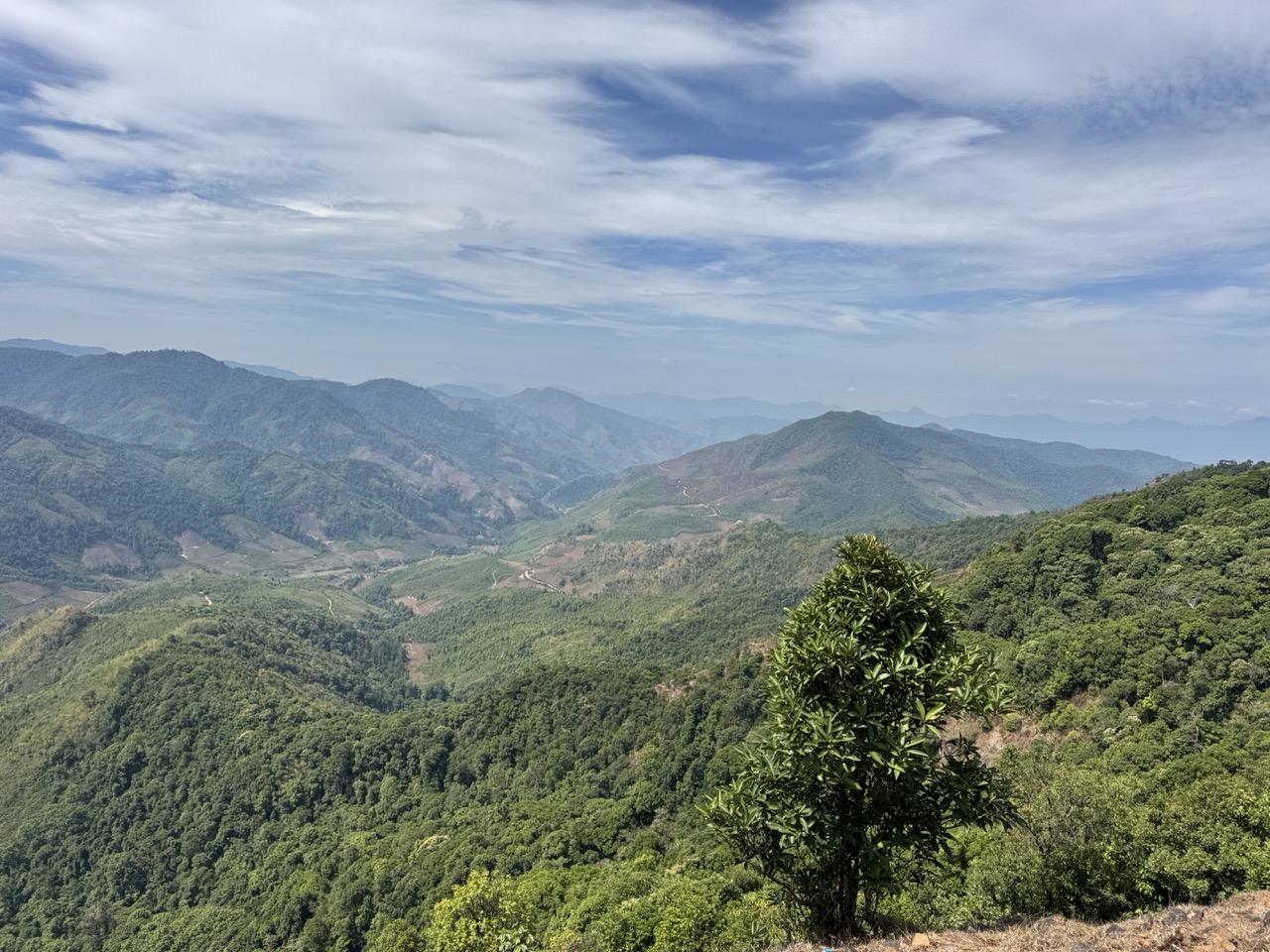
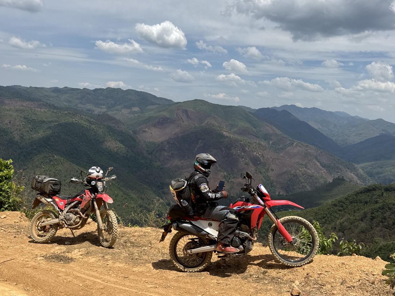
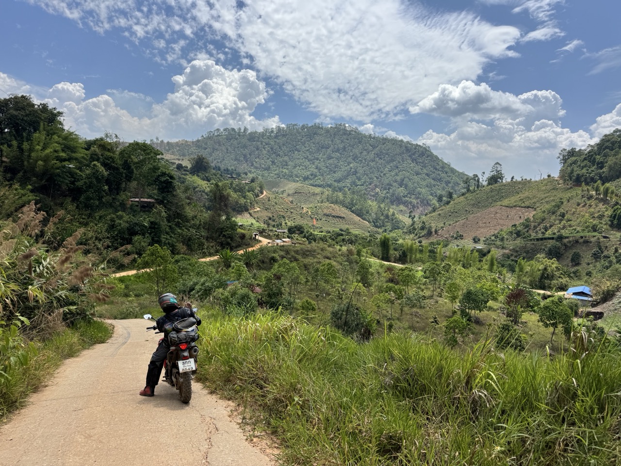
If we had to pick a favourite day, this was it. On the map it looks short — only ~170 km — but it took us the entire day. Almost none of it is sealed. The route west from Om Koi climbs onto a long, undulating ridge that forms the spine between Chiang Mai and Mae Hong Son provinces, and then for hours you just ride along the top of it, dropping into hill villages and climbing back out, with views that open into Myanmar on a clear day.
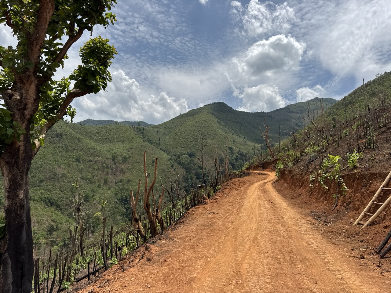

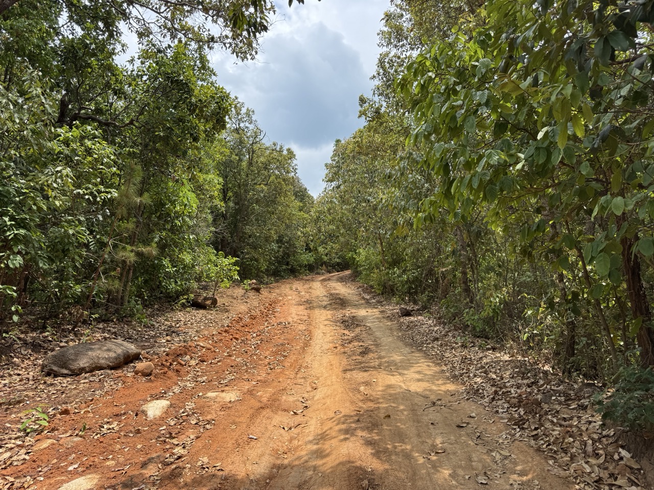
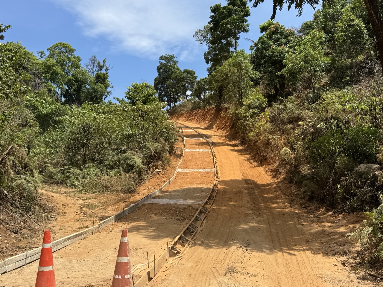
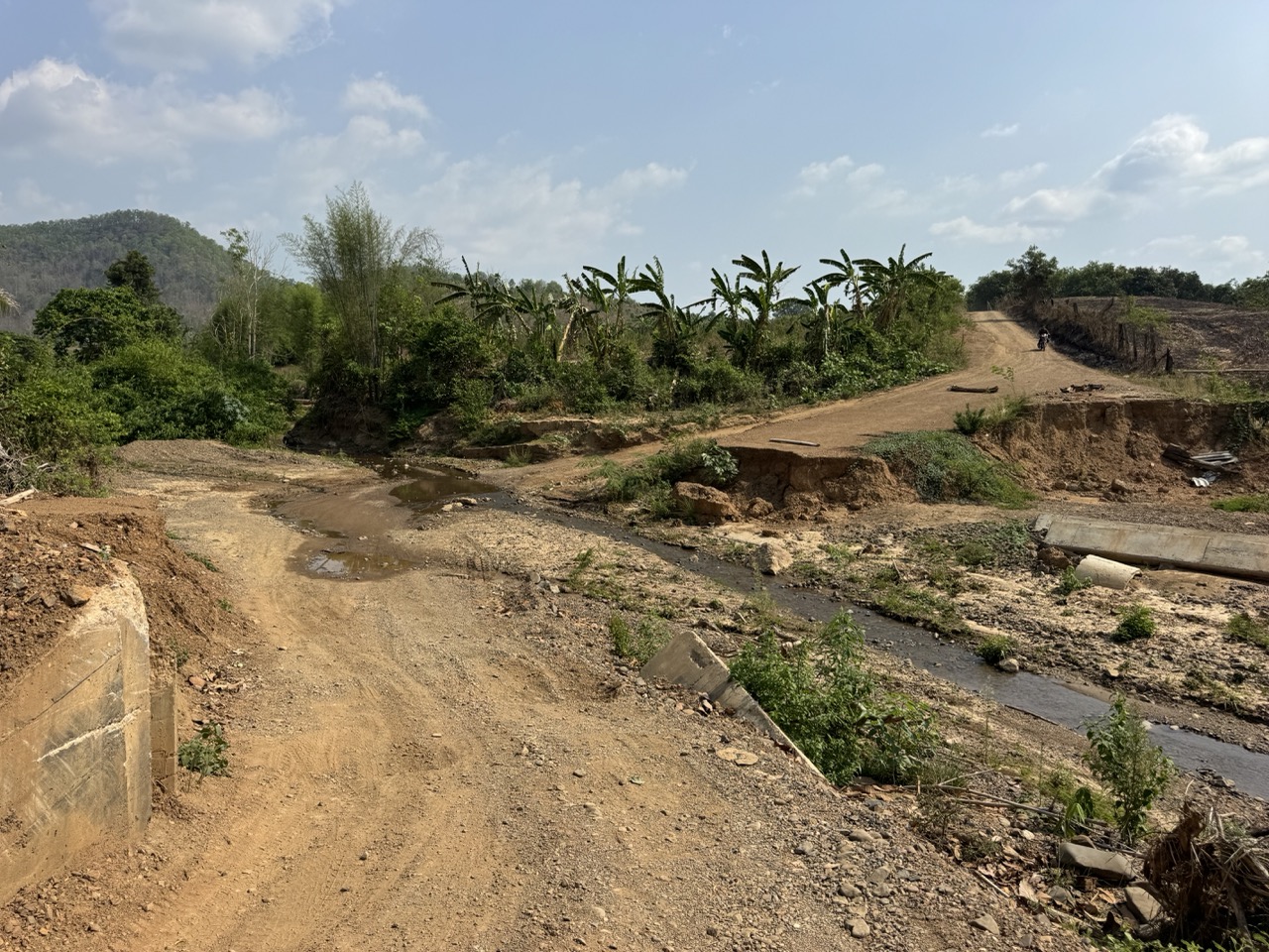
There are a few small Karen villages strung along the ridge where you can buy water and snacks, but full-service shops are rare. We carried 1.5L of water each and refilled at any opportunity. The road quality changes constantly: stretches of fresh red dirt with orange traffic cones marking new earthworks, washed-out concrete steeps, and rocky single-track descents into stream crossings.
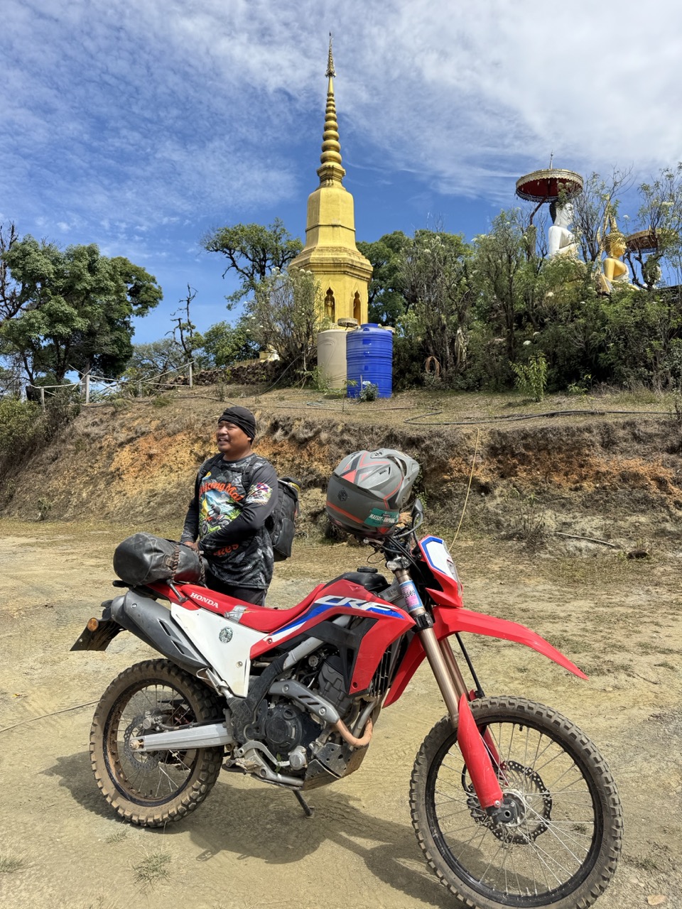
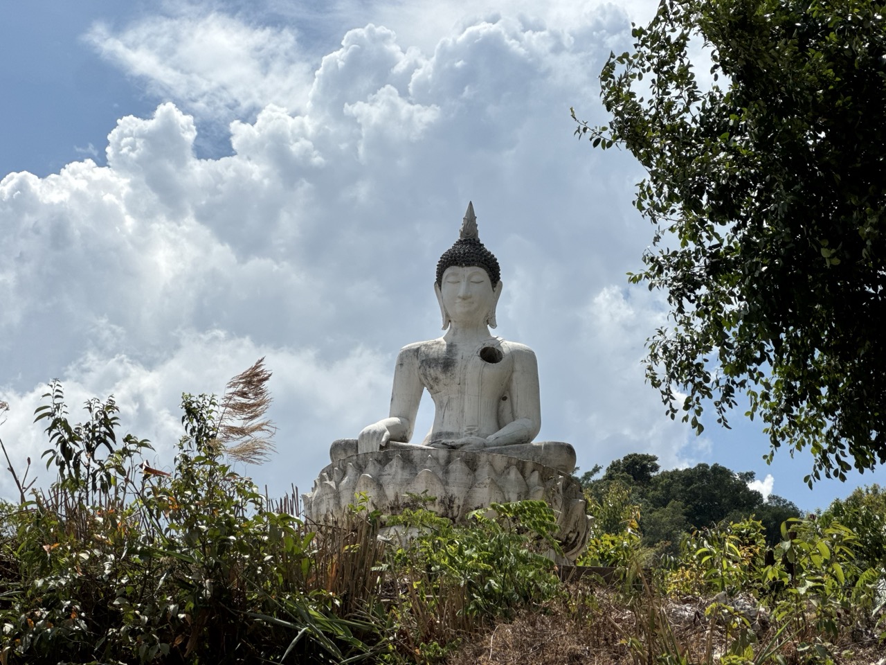
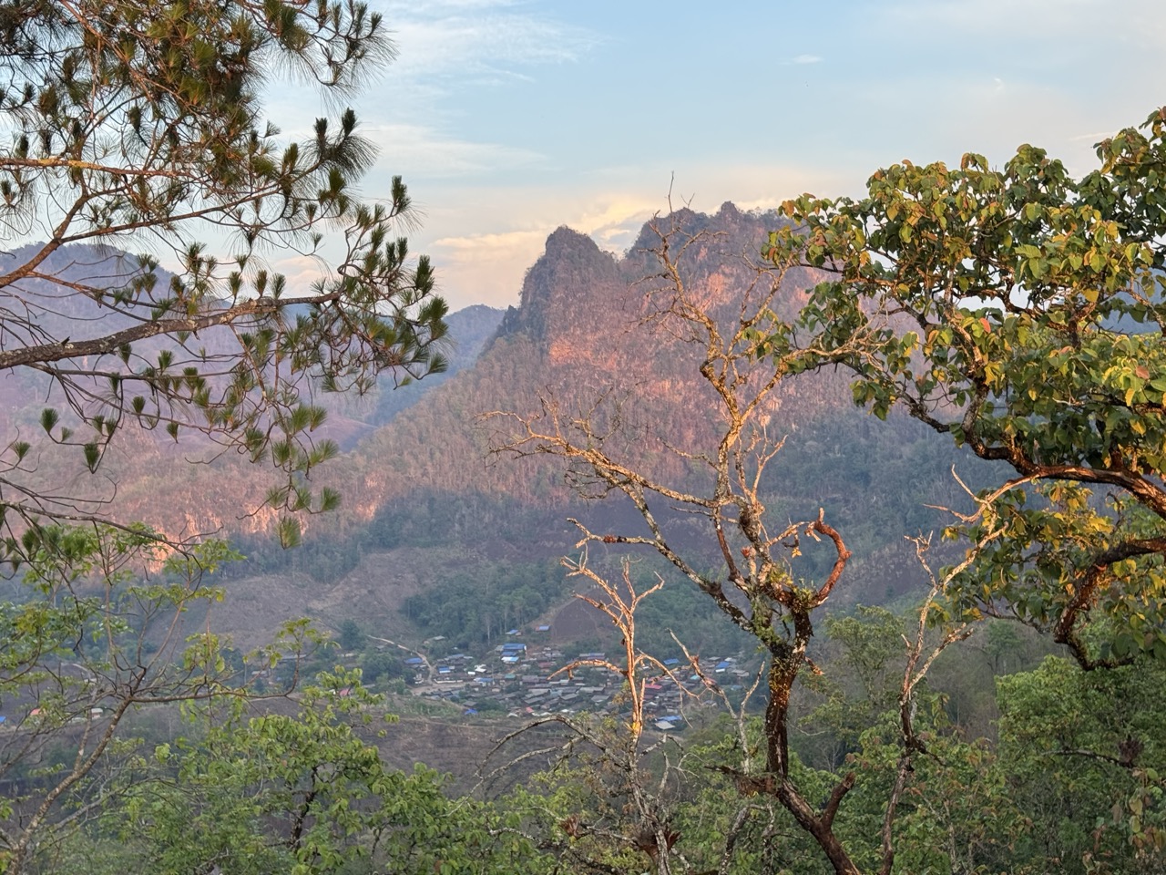
About halfway through the day the ridge opens onto one of the prettiest viewpoints of the trip — a small hilltop chedi with a panorama in three directions, and another hill nearby crowned with a white Buddha statue visible from miles away. It's the kind of place that exists at the end of a 30-minute climb on a dirt road and has maybe four visitors a day, all of them on bikes.
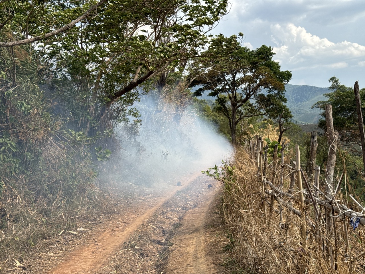
By mid-afternoon we'd dropped off the ridge and started crossing into Mae Sariang district. This is the part of the route where burning season makes itself obvious — small fires along the trail edges, smoke drifting across the road in patches, and the smell of woodsmoke baked into your jacket by the end of the day. It's eerie but rideable; you slow down through the smoke, give it space, and keep going.

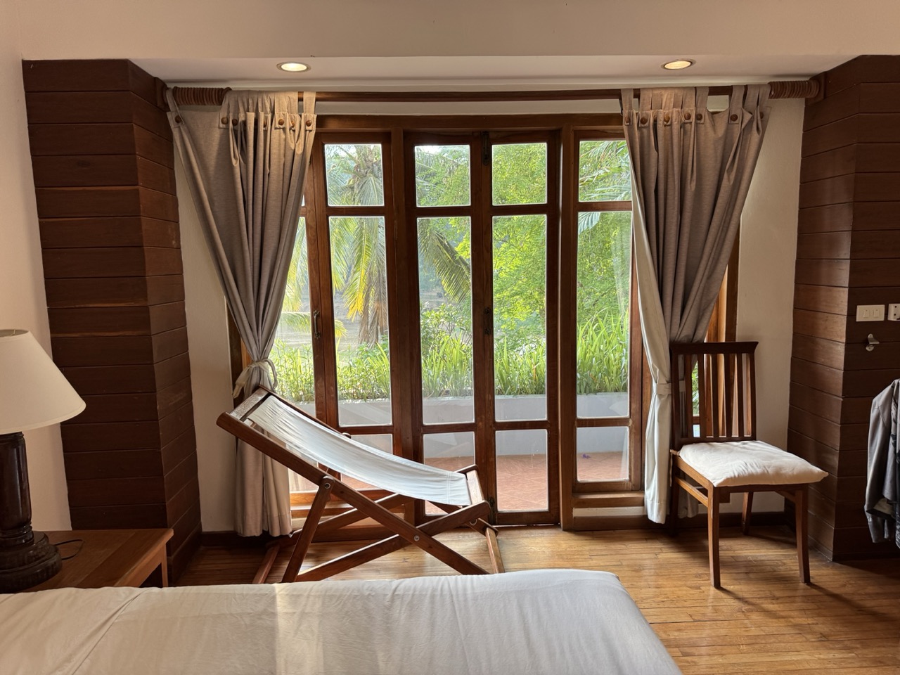
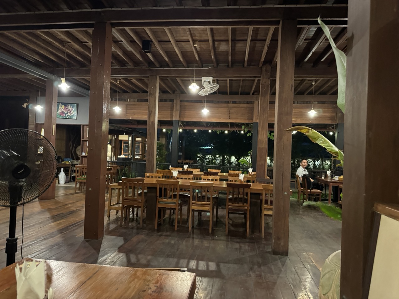
We rolled into Mae Sariang town as the light went, dust-caked, and checked into the Riverhouse Resort. The Riverhouse sits right on the Yuam River — wooden teak rooms, a deck looking out at the water, and the kind of quiet that you don't fully appreciate until you've spent eight hours on dirt. Hot shower, cold beer, dinner at the open-air teak restaurant attached to the hotel.
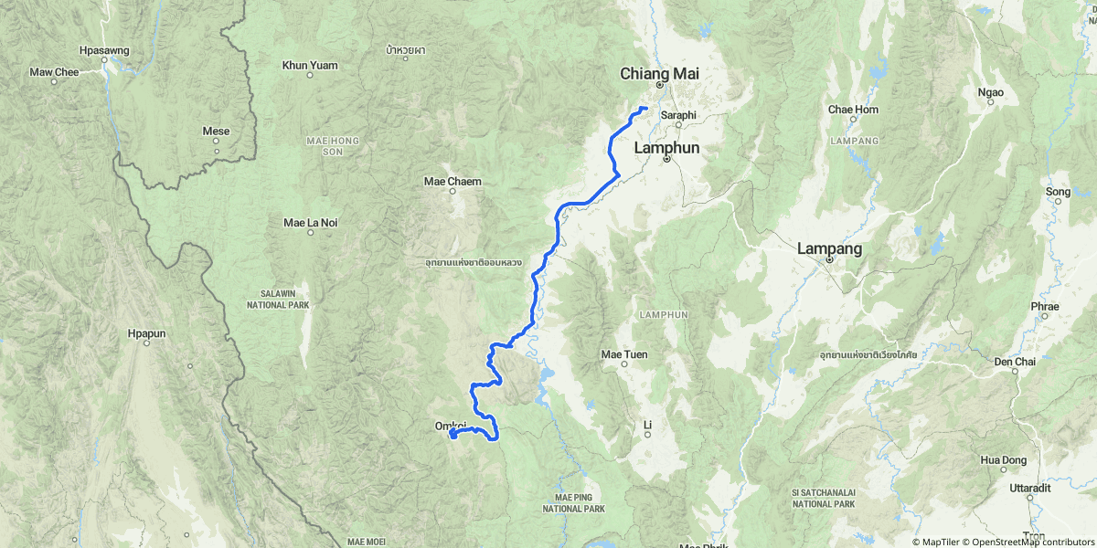
Day 3 — Mae Sariang to Pai (~326 km)
The longest day of the trip — over 320 km on the GPS, including all the wandering — and probably the most varied. We left Mae Sariang heading north and almost immediately turned off the paved 1095 to follow village tracks through Mae La Noi district. This is rolling, scenic terrain: rice paddies on the valley floor, banana plantations on the slopes, dirt tracks linking village to village.
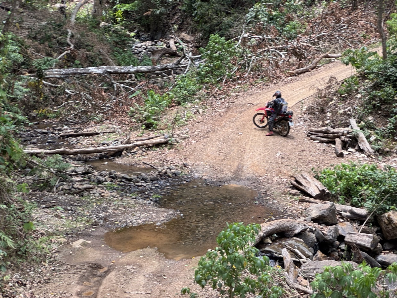
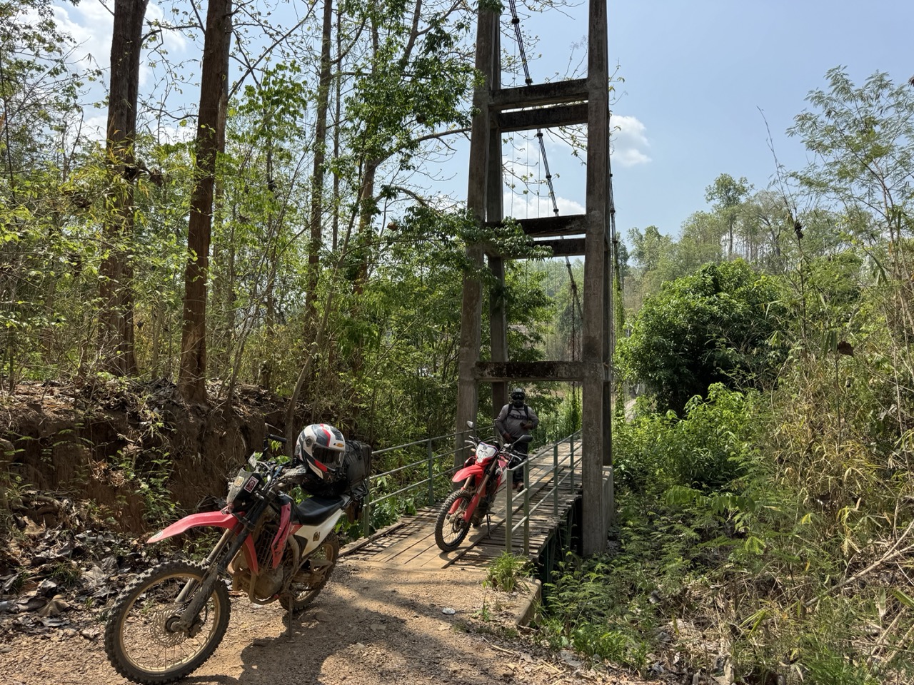
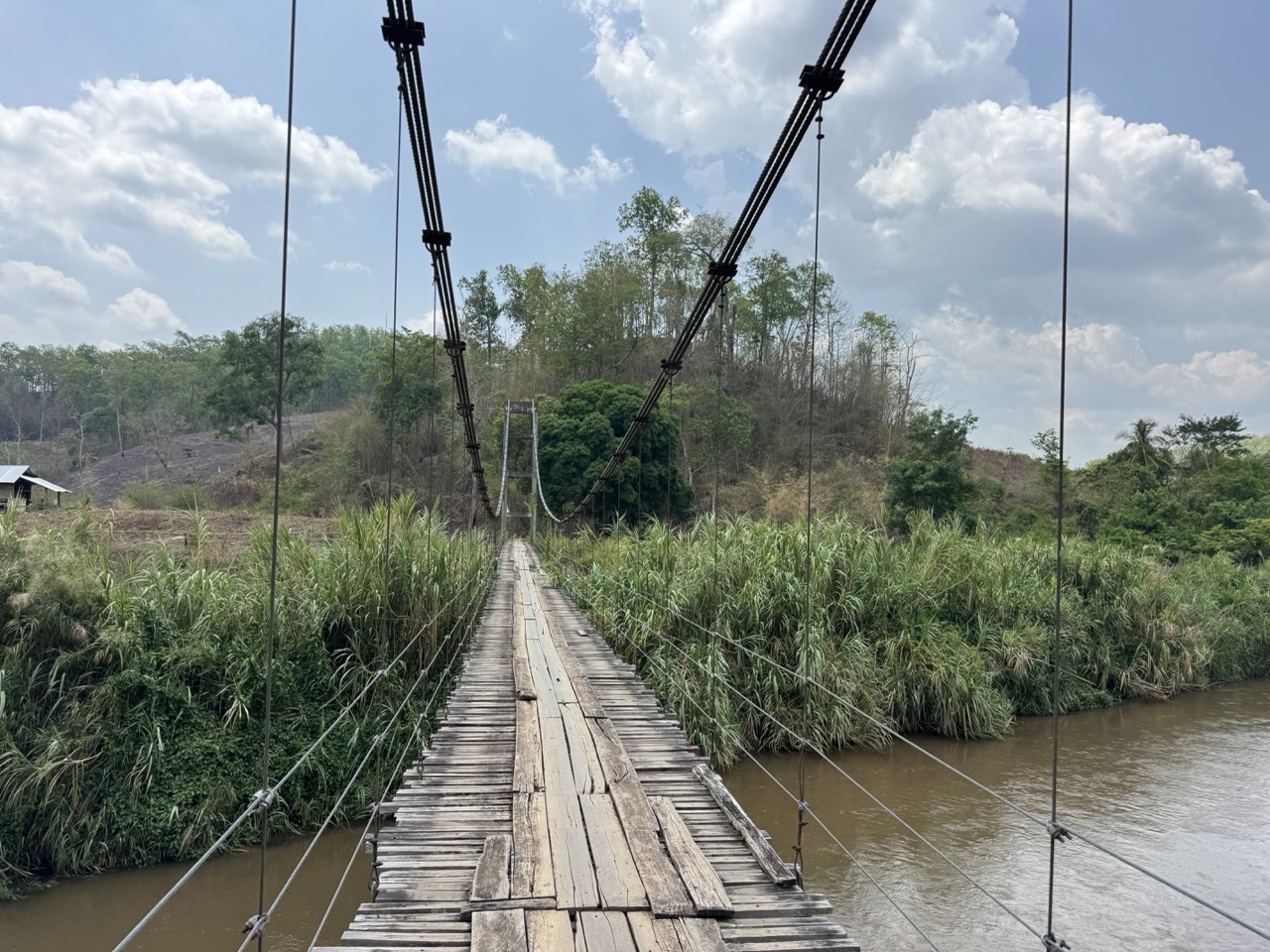
Highlights of the morning included a long pedestrian suspension bridge — the deck just wide enough for a single bike — and a string of small water crossings, none of them deep, all of them welcome on a hot day.
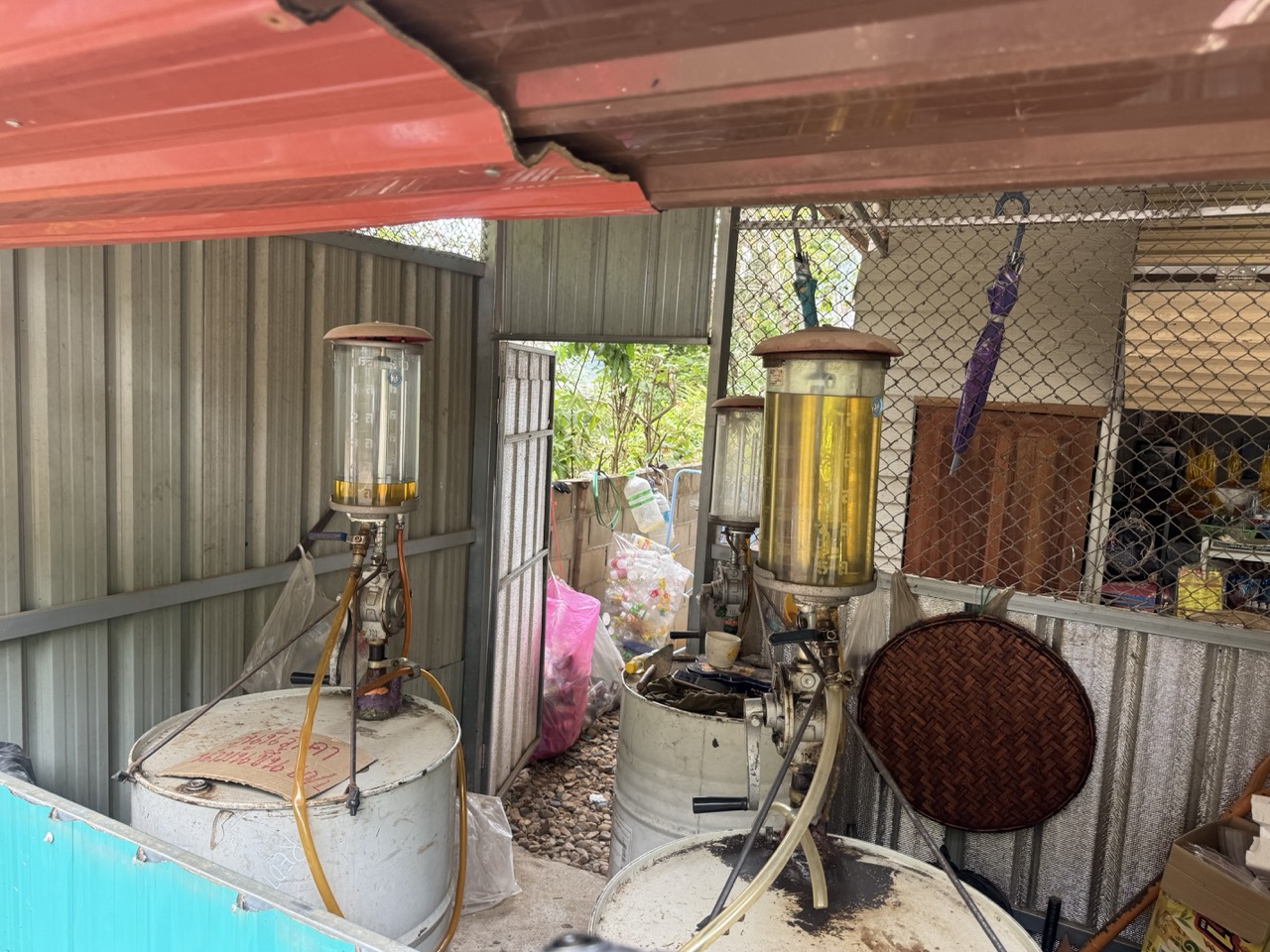
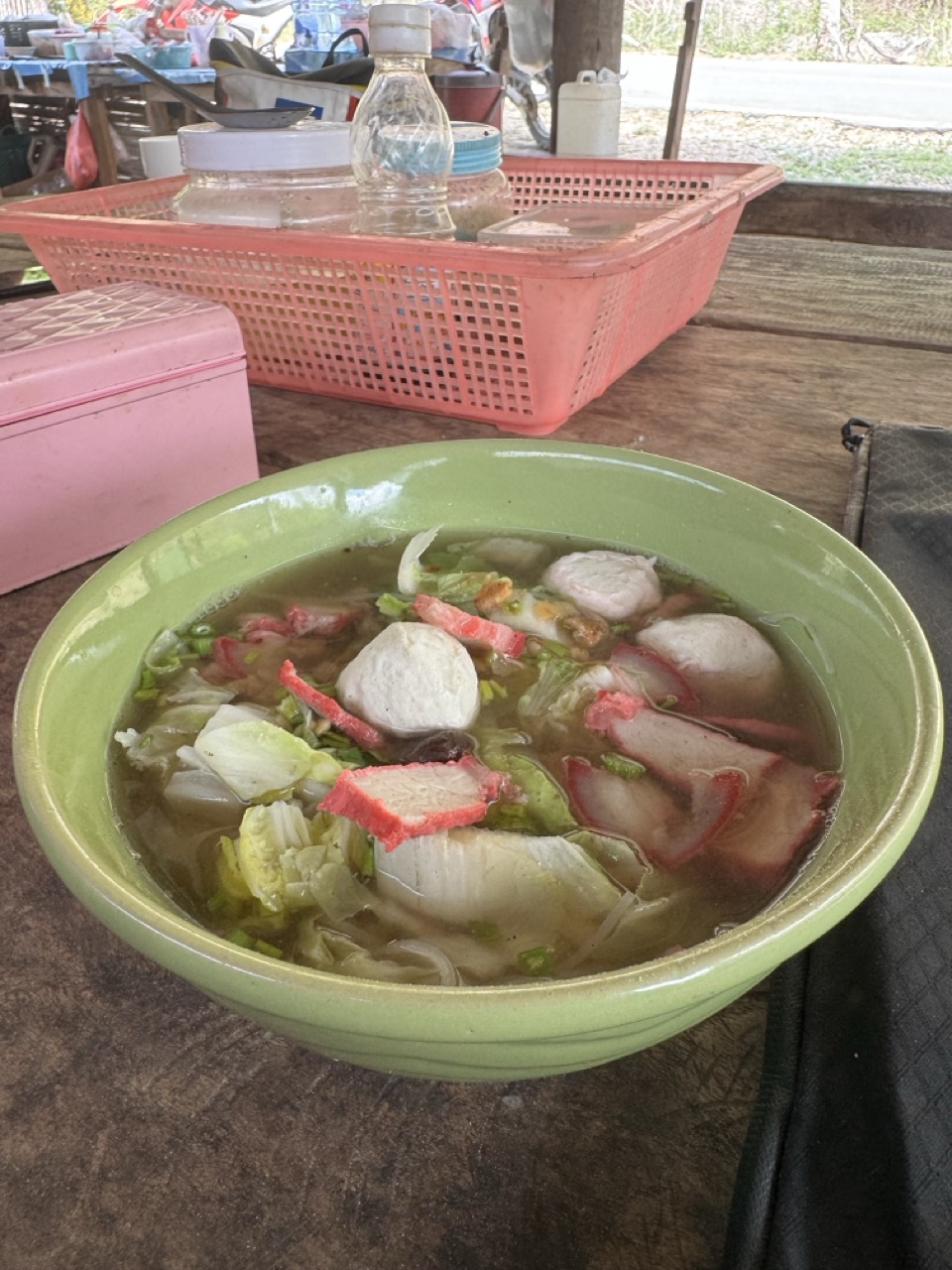
Khun Yuam is the kind of small town that exists in your memory mostly as a fuel stop and a noodle stop. Both deserve their place. The petrol station was the old-school kind — glass-bowled hand pumps, the attendant doing the maths in his head. We filled both bikes and grabbed a fishball noodle soup at a roadside stall up the road.
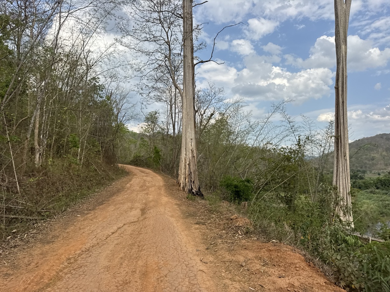
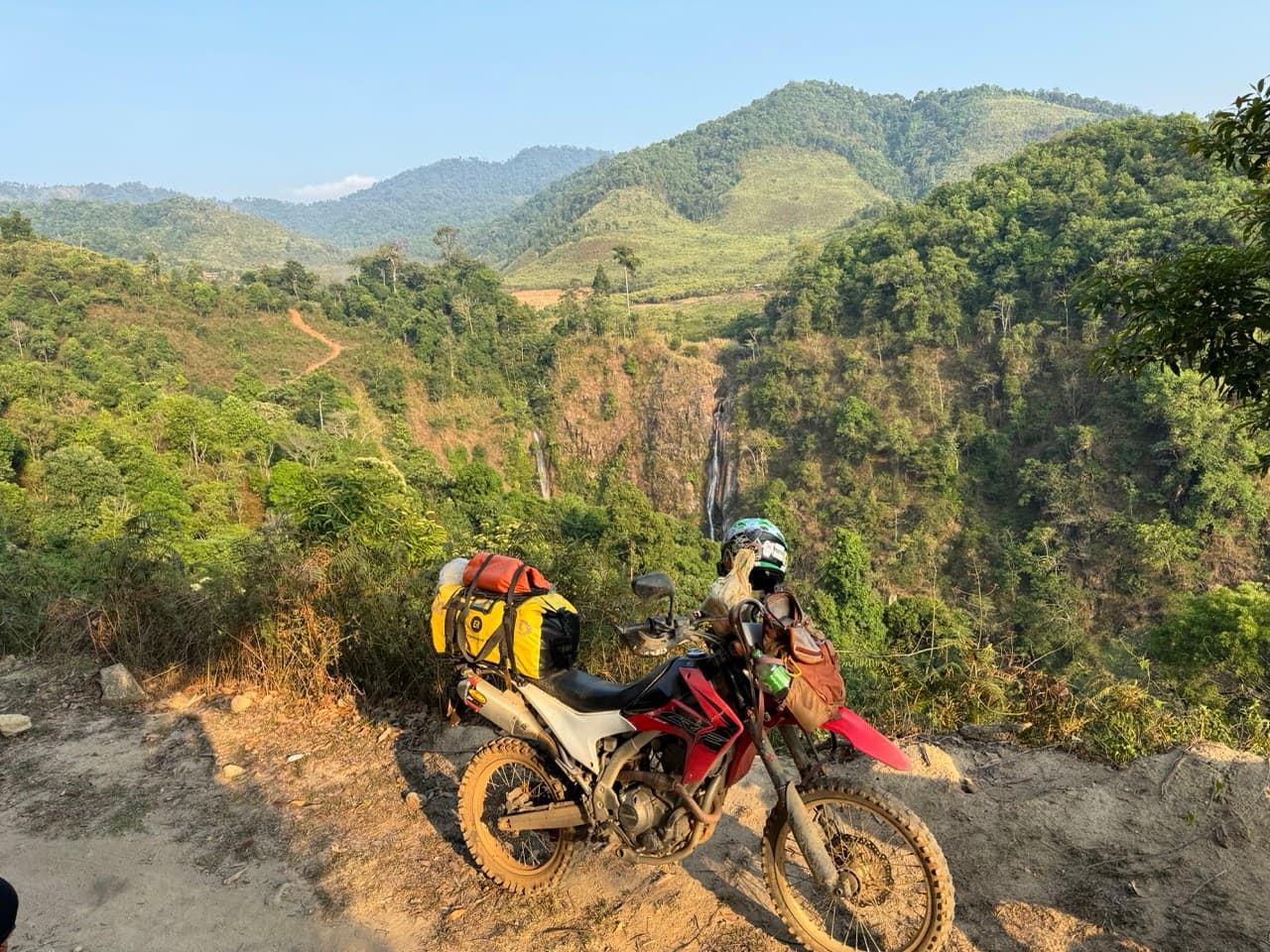
Past Khun Yuam we picked up another section of dirt — narrower this time, with deeper ruts and the occasional muddy puddle that hadn't quite dried out. It dumps you eventually onto a beautiful orange-dirt road that runs between unusually tall trees, then concrete water fords, a wooden footbridge over a creek, and a long climb to a hilltop where a single dead tree stands on an eroded slope. Stop, breathe, take the photo, ride on.
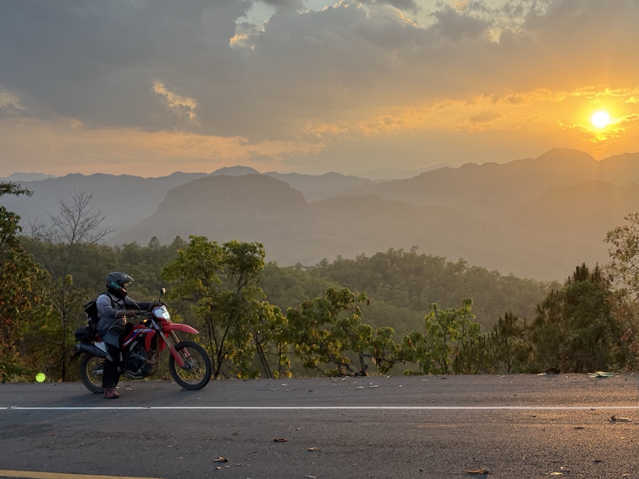
We bypassed Mae Hong Son town itself — we'd been before, and we wanted to make Pai by sundown — and pushed northeast through Pang Mapha. The final stretch is one of the great motorcycle roads in Thailand: the 1095 from Pang Mapha to Pai, all curves and pine forest, climbing through the highlands as the sun gets low. We caught it at golden hour.
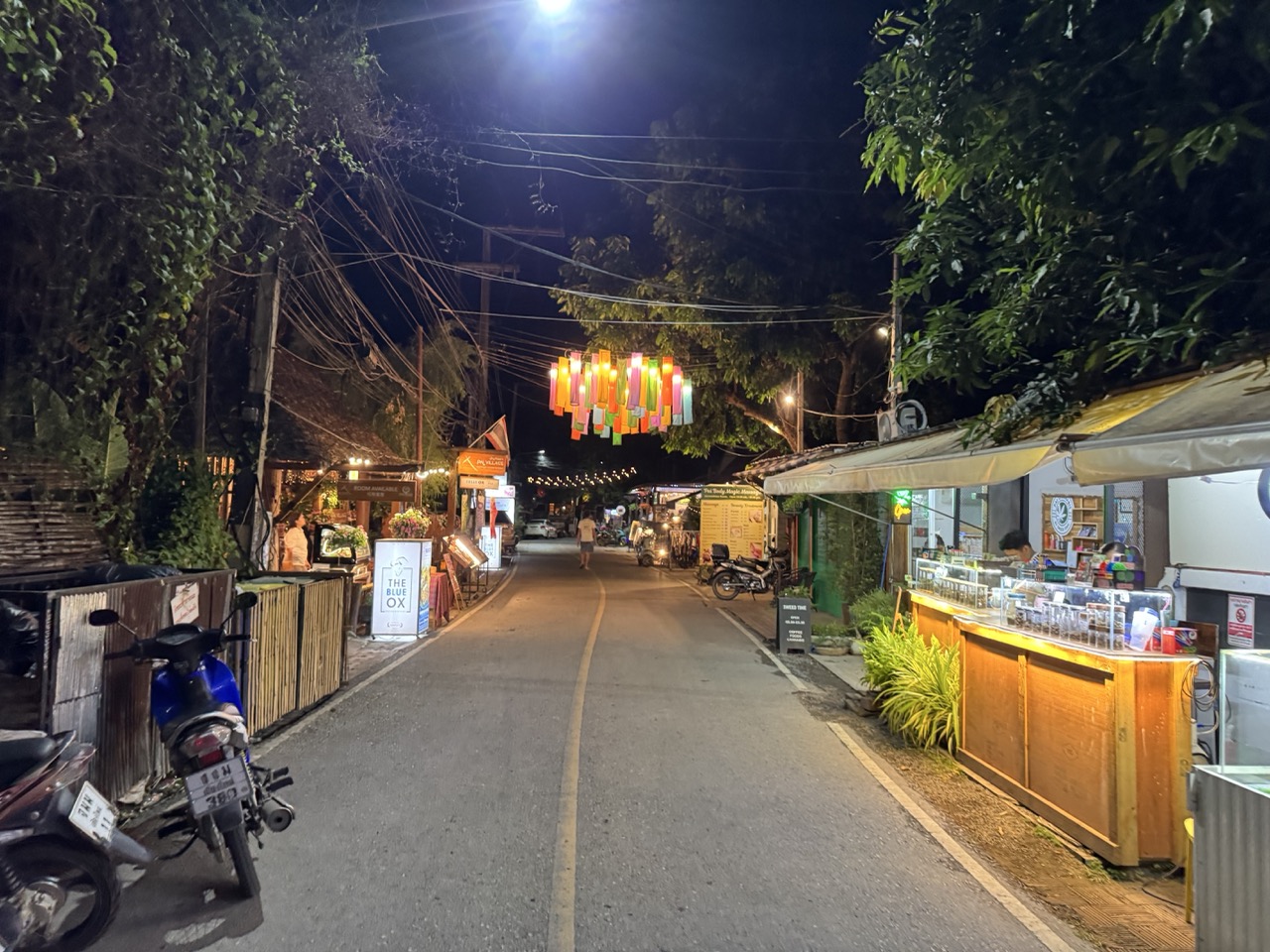
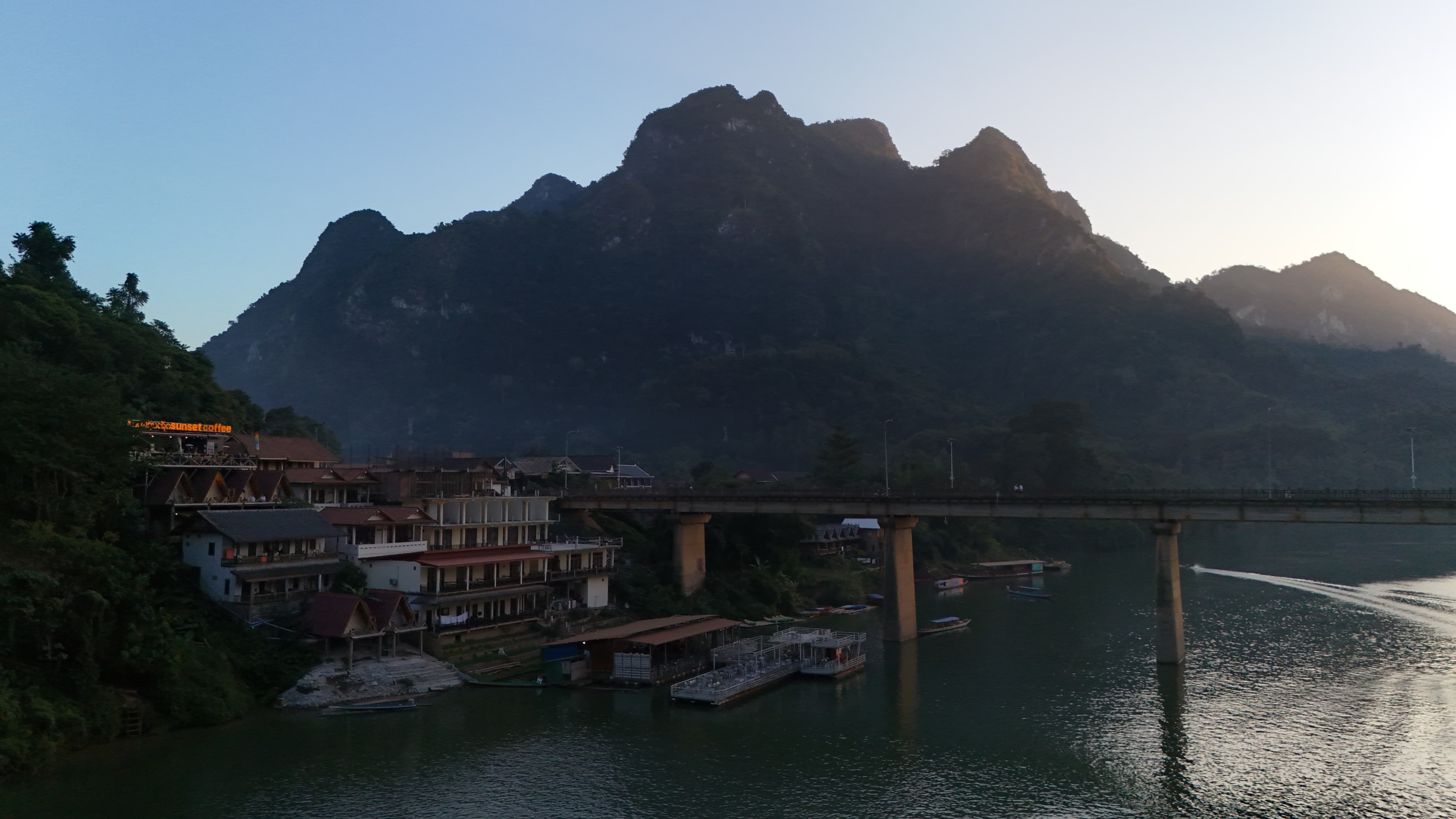
Into Pai after dark. We checked into AI Pai — clean, modern, easy walking distance to the night market — dropped the gear, walked into town, and ate our way down the lantern-lit walking street. After three days in places where the night ends at 9pm, the buzz of Pai is a culture shock you don't quite know what to do with.
Day 4 — Pai to Chiang Mai (~171 km)
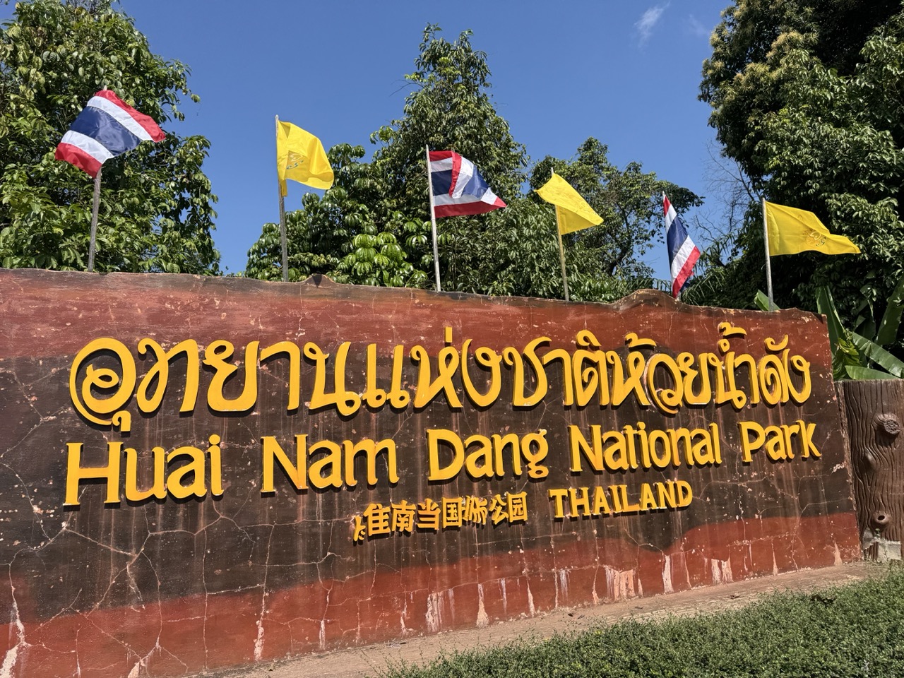
The standard route from Pai to Chiang Mai is the famously twisty 1095 — 762 corners, give or take, depending on whose count you trust. We took it for the first stretch and then turned off into Huai Nam Dang National Park, which sits along the ridge between Mae Hong Son and Chiang Mai provinces. The park's main road is sealed, but the side tracks through the pine and grassland are open to bikes and almost completely empty on a Monday morning.
Out of the park and into Mae Taeng district, we passed an elephant village — one of the camps that runs day visits up the valley. We stopped to look, didn't take a tour, kept moving. Worth being thoughtful about which elephant operations you support up here; the better ones don't run rides.
Last stop of the trip was a roadside cafe in Chiang Dao — the limestone massif of Doi Chiang Dao filling the windscreen north of us. Coffee, the last decent view of the trip, and the realisation that we were about to be back in city traffic in 90 minutes.
By late afternoon we were back at the shop in Chiang Mai. ~860 km on the trip clocks, a thick layer of dust on everything, and a route file that we'll be looking at again.
If You're Thinking About Doing This
A few practical notes for anyone planning the same kind of loop:
- •Bike: a CRF250L, CRF300L or KLX250 is the right tool. Bigger adventure bikes will make it through but you'll regret them on the Om Koi ridge sections.
- •Tyres: dual-sport tread minimum. Knobblies are nicer but not required if conditions are dry.
- •Fuel: fill up at every small-town station. The longest gap between fuel stops on this loop is around 100 km in dry season.
- •Water: 1.5–2L on the bike, refill every chance. We rode in 35°C+ heat by midday.
- •Maps: download offline maps for the whole region. Phone signal in Om Koi and on the Mae La Noi back roads is unreliable.
- •Season: November to February is the textbook window. We rode at the start of May because it fitted our schedule — the trade-off was burning-season haze and fast, dry trails.
- •Pace: 4 days is comfortable. 3 is rushed. 5 lets you stop and talk to people.
The standard Mae Hong Son loop on tarmac is one of the great motorcycle rides of Asia. The dirt-bike version, with the Om Koi detour and the Khun Yuam back roads stitched in, is something else again. Less photographed, harder to plan, and quieter on the trail. If you've got the bike for it, do it.
GPX files for all four days are sitting on this site if you want to follow the same route. Tweak them to your own pace — the long Day 3 in particular splits nicely into two days if you have the time, with a Mae Hong Son town stop in the middle.
Explore Routes
Browse our curated collection of dirt bike routes throughout Northern Thailand.
Browse Routes